The Colorado Springs Elk’s Lodge is smack dab in the middle of town. They have a nice Lodge facility but limited RV hookups which need a little more attention than they get. With a no reservation system, we arrived and the hook up sites were full. Well, sorta full. Of the approximate 13 sites, one was used for parking two cars in, one space was taken by the lodge trailer (I think for their veteran’s program equipment), and the sites are so skinny it could be problematic with dueling slide-outs. The lodge seeks “donations” of $25/night for the hookups (W/30A), with a dump station on site. They have a large paved parking lot and allow dry campers to stay…but seek “donations” of $15/night for boondocking. A little overpriced in both instances.
This was a short stopoff for us. Being the big city town that Colorado Springs is, Jeanne was overwhelmed with joy to find Trader Joe’s & a Costco. We made good use of the opportunity to supply up. What little time for sightseeing we had, Jeanne found the Royal Gorge Bridge & Park about an hour’s drive away near Cañon City. We headed out there early enough on the Saturday of Labor Day weekend that we had easy parking at the visitor’s center of the park. We paid the $30/person fee (Youch!) and wandered the park unencumbered by thick holiday crowds. Jeanne was a little apprehensive about walking the bridge over the Arkansas River (it does tend to shake, rattle, and roll a bit), but she mustered the courage and conquered the approximate quarter of a mile walk. The amusement park itself has various activities (some come with additional fees!), but none of them garnered our interest other than I took the aerial tram ride across the gorge, Jeanne took a pass on that. The views from the tram were a bit obstructed by the foggy/scratchy plastic windows. The park has zip lining across the gorge that was pretty popular, as was a bouncy thing-a-ma-jig, some type of bungee-bouncy-swing perched on the edge of the canyon, I think they call it the Sky Coaster. There are areas for small humans, including a carousel ride, playgrounds, and the park is extremely dog-friendly, K-9s everywhere! A couple of small stage areas are set for live bands (one was sound checking as we were leaving). The walk across the bridge provides great views of the Arkansas River 956’ below, where we watched white water rafting enthusiasts float downstream. There is also a train ride that follows the river, at river level, with viewing cars set up for folks to ogle the scenery.


We left the park as it became absolutely jam packed and the parking lot a nightmare of cars circling like sharks, waiting for that one rare opportunity to present itself. On our way back home, we took the very short side trip onto Skyline Drive. This is a one-way skinny paved road along the Dakota Ridge above Cañon City which provides good views of the valley and nearby mountains. There is also a walking trail along the ridge for those so motivated.


Since our arrival in Colorado Springs we managed to return to “life with smoke”. It seems the smoke from the currently burning left coast wildfires is off-and-on wafting it’s way over the nearby states, including Colorado, so here we go again, breathing labored and eyes afire. It has truly gotten old at this point. Our next stop was just a breather (oh when oh when will the puns stop?!?!?) at the Douglas KOA in Wyoming. Yes, we got rested. And yes, smoke still reigned.

Our home at Douglas KOA 
Typical sites at the KOA 
A little smoke-aided “Good morning” to ya… 
Thanks, Kalifornia!
We wanted to explore the Little Big Horn Battlefield (the site of Custer’s last stand for those of you hoodlums who ditched history classes) near the big city of Garryowen, MT. It is a National Monument run by National Parks Service and is really out in the middle of nowhere, not many choices for RV parks nearby. We found the 7th Ranch RV Camp just a couple of miles from the monument, so we called 7th Ranch home for the next couple of days.


The “battlefield” is actually 2 separate battlefields about 5 miles apart. From the visitor’s center/park gate a paved road travels the 5 miles from the area of Custer’s battlefield and his Last Stand Hill to the Major Reno-Captain Benteen battlefield. There is an audio tour available or you can do as we did and explore on your own. Points of interest are well marked and most have signs describing the sights before you. There is an Indian memorial, an Army memorial, and a National Veteran’s Cemetery on site. After the slaughter (Custer & his troups were severely outnumbered by the various Indian tribes involved), the army dead were allegedly buried where they fell. Some years later the officers were exhumed and transferred to other cemeteries around the country, Custer himself was moved to West Point. The remaining deceased were also exhumed and re-buried in a mass gravesite at the top of Last Stand Hill at the Army memorial. All original Army gravesites are marked by white marble headstones, a few with names, most with the generic “U.S. Soldier 7th Cavalry”. The Indian casualties are not accurately accounted for but estimated in the 60-100 range. They were immediately moved by surviving tribe members to traditional burial methods. There are a few red granite headstones scattered in and amongst the battlefields that depict the location where certain named Indians fell in battle. It was about a 3-hour excursion for us to cover both battlefields and other points.


From the megalopolis of Garryowen it was off to another breather stopover in White Sulphur Springs, MT, at the Conestoga Campground and RV Park. Our purpose and aim was and has been to check out some properties all around Montana for a possible landing zone for when we decide to come off the road. From here it was on to the Gallatin County Fairgrounds in Bozeman, MT for a longer respite while checking out lots for sale.

Welcome to Conestoga RV Park 
Not real crowded… 
Our home at Conestoga RV 
Even little ol’ White Sulphur Springs lays claim to a craft brewery… 
Inside 2 Basset Brewery
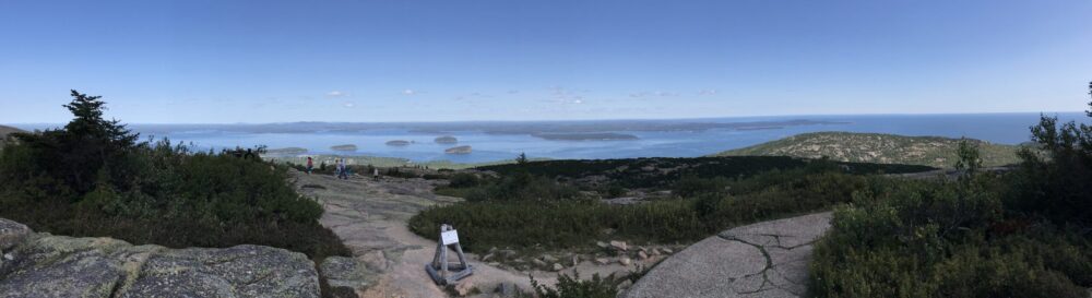
In all our running around in the Bozeman area we did manage to squeeze in a hike up the mountain. Jeanne found a mundane sounding “College M” hike, a trail up to the big white “M” created out of painted rocks to designate MSU. There are basically 2 trails up; the shortest, most direct route a little over a half mile one way, the other “easier” trail about a mile and a half that zig-zags up to the “M”. Jeanne, feeling her oats, chose the short route for our uphill trudge. That decision was second-guessed most of the way up, it was WAYYYY steep, lots of gravel and rock face climbing, and she nearly gave up several times. But bless her soul, she muscled up and completed the climb. It turned out to be more than a 600 foot elevation gain in that short half-mile. Enjoying the views while we caught our breath, we were treated to a solo paraglider buzzing the mountain face. Breathing back to relative normalcy, we chose the safer, longer trail back down to the trailhead. All told it was a little more than 2 miles round trip for this “mundane” hike. Well worth the effort…


Of course, with Montana taking pride in their craft beer industry, Bozeman had no shortage of adult beverage dispensaries. Over the course of our 5 day stay (yeah, no, we are not quite ready for the 12-step shuffle) we forced ourselves to test the waters with a little sampling at MAP Brewing Co., Outlaw Brewing Co., and the Bozeman Brewing Co. They all had worthy endeavors.

A little interior art, MAP Brewing style… 
Inside MAP Brewing 
This guy has a cool beard… 
Welcome to Outlaw Brewing 
Outlaw Brewing, on the inside 
Welcome to Bozeman Brewing
So here we sit, at the end of our Bozeman experience, contemplating the fate of the world, throwing darts at the map of the U.S. trying to figure out what state we want to “live in” next. Stay tuned…