About rvrrat520

Retired L.E. from Sonoma County, CA. We've been full time RVers for 8 years, covering all lower 48 states and not nearly seeing a fraction of what is out there. Enjoy life in the "here & now" for the future is not guaranteed. Live, Laugh, Love...Grandkids rock!

Views From the North Shore Scenic Byway (aka: Hwy. 61 Along Lake Superior)

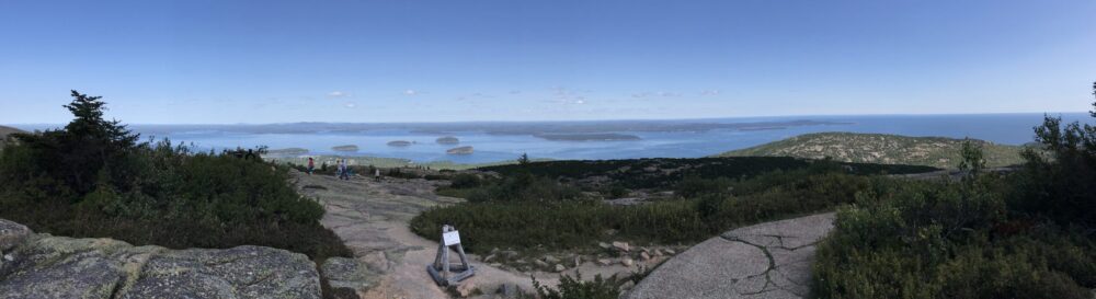
With Voyageur’s N.P. in our rear-view mirror, it was southward-bound. Still having issues finding available space at the RV parks, we snagged a one-nighter at the Cloquet-Duluth KOA and caught a couple more nights at the Tettegouche State Park. Between both stays, we managed some minor hikes to sights between Duluth and Grand Portage (the US/Canadian border), about a 146 mile stretch. As a start, Minnesota Point is a narrow strip of land projecting out to “sea” (meaning onto Lake Superior) which has several beach areas. Driving out that way we got some expansive views from the roadway looking down at Duluth. The day we were there it was not the greatest of beach weather, but the beaches were still pretty busy. On our way out of the area we got to see an “Aerial Lift Bridge” in action. That would be a form of a draw bridge that leads to the Duluth Harbor Basin. At the mouth of the canal they have the Duluth North Pier Lighthouse and the Duluth Harbor South Breakwater Outer Light, as well as the Duluth Harbor South Breakwater Inner light. Snapped a few pix, waited for the boat traffic to clear the aerial lift bridge, and off we went for more adventure.

Congdon Park in Duluth is home to Tischer Creek and the Tischer Creek Falls. They put in a nice creekside trail that was about a mile and a half of small waterfalls. We let Woodrow Wilson take us on that walkabout. Here’s a mishmash of sights along the trail…

The town of Two Harbors contains the Two Harbors Lighthouse Museum as well as the Two Harbors Lighthouse. We weren’t real keen on seeing ANOTHER lighthouse museum, but we hoofed it out to the lighthouse for views of town and the lake. Right across the bay from the lighthouse there was an interesting iron ore mining/processing center.

Beaver River Falls, located on, oh, let’s guess…the Beaver River, in, maybe, let’s see, the “town” of Beaver Bay, on, well, Beaver Bay of Lake Superior was another of the advertised “10 Best Waterfalls on Minnesota’s north shore”. Well, maybe in another life. At present time there was very little water in the river, so the “falls” were less than spectacular.

Split Rock Lighthouse is a popular tourist stop along the north shore. We opted not to pay the $24 to be able to get up close and personal with it, mainly because I am a cheap b@$t@rd and we have actually seen our share of lighthouses, both coasts and all points in between. But they had a nice wayside rest that had a clear view of the lighthouse, so I got my pix anyway.

Gooseberry State Park contains Gooseberry Falls with a short hike to see them. The hiking trails are easy, well kept and travelled, and parking can be a zoo during season. They say there are (5) total falls along the river here, but we kept to the main touristy few.

Tettegouche State Park gave us a pretty good workout. The trail to get to Two Step Falls was a mere one tenth of a mile from our house. The only issue was then it was a matter of 200 stair steps straight downhill to get to the viewing area. I know that I sucked a lot of air getting back to the top, but it was worth the view. High Falls was only a half mile hike from our house, but then it also added 100+ more stair steps, straight downhill. Again, the view was worth it and you also encounter  the swinging bridge. On a more even note (terrain-wise; “even”, get it?!?) it was an easy walk down to see the mouth of the Baptist River. We happened to accomplish that one early in the morning with NO beachgoers anywhere to be seen. 

Caribou Falls was another disappointment. We let Woody lead the way along the path which followed the Caribou River. They advertised less than one mile to get to the falls, however, the river was pretty sad water  volume-wise. We hiked more than one mile and saw no end in sight. I had my suspicions about the location of the falls and think we passed by the area without realizing it. The photos advertised were obviously in a heavy torrential setting, far from what we were looking at. It was still scenic, as the pictures suggest.

The Cross River Falls were pretty cool even though the water was low there as well. And these were right off the highway with no hike required.

Temperance River State Park is home to the Temperance River Falls. These falls landed into some deep gorges and again, this was right off the highway with very little hike to get to.

Cascade River State Park contains its namesake falls. These also included some fairly deep gorges. With most of the sightseeing points of interest located within various state parks, it is very convenient that if you pay for any of the park entrances ($7 per car/day), your pass gets you into all the parks. And as you can see, there are a lot of state parks  here on the North Shore.

And for our grand finale, we hit up Pigeon Falls on the Pigeon River at the US/Canadian border. In the advertising for these falls they are likened to another border waterfalls area, namely Niagara Falls. Sorry, no where near in the same class as Niagara and not even close to size and scope. But still, these were pretty cool falls, with an easy paved/boardwalk path to get to them.

OK, so I hope I left nothing out. And I really really really hope I get the right photos with the right narrative. But, hey, if I don’t, sue me. If you can find me. And remember, you should click on each of the photo blocks to be able to see the photos uncropped, in a carousel manner. Until next post…

Land of 10,000 Lakes

Voyageurs National Park was our next tourism destination. We broke the drive up and did a couple of nights at the Jackpot Junction Casino in Morton, MN. While there we found a couple of points of interest to see. The Birch Coulee Battlefield was a small area on the outskirts of Morton. It is touted as one of the bloodiest battles of the U.S.-Dakota War even though it was only a day and a half battle back in 1862. That, and there were only about 20 men killed during that skirmish. Horses fared worse, they had about 90 casualties.  The battlefield was a short walking circular path through the field, with little history lessons posted here and there. They also had small concrete markers with footprints on them to designate the standing location of combatants, pointing out  into the field to small white marker posts which designated the locations of enemy fighters. This battle was pretty much a close quarters type of battle as evidenced by the distances depicted, and it easily demonstrated the ill-fated logic of the U.S. force on choosing such an open, unprotected location to set up camp.

The other point of interest was Ramsey Falls on Ramsey Creek in the town of Redwood Falls. This was an easy drive-to with no hiking required. There is a nice viewing platform at the parking area, and if you want a closer look you can do a tiny bit of rock scrambling to arrive at the top of the falls.

Onward and upward, again, we lucked out and I think we found the absolute last available RV site in the entire Great Lakes area. It just happened to be Arnold’s Campground and RV Park in International Falls, MN. Now, the town of Int’l Falls is nothing to write home about, it is a run down small town right on the Canadian border. In fact, if the U.S. side residents need to hit a Walmart or a Safeway, the only ones in the area are across the Rainy River in Fort Francis, on the Canadian side. And, according to signs posted around Rainy Lake, all non-essential cross-border traffic is prohibited. So there’s that…

I have to say, we were seriously underwhelmed by Voyageurs National Park. Even the rangers say it is not a real popular park in the Nat’l Park system. We hit the 3 visitor’s centers at Rainy Lake, Kabetogama Lake, and at Ash Creek. They are not open every day, even during this, the peak season, which tells you a little something about their popularity. We were in serious lake country (“Land of 10,000 Lakes, duh!) but driving around and through the area the scenery is mostly thick, green trees. Even the “lake view” trail near the Ash Creek Visitor’s Center provides you with a semi-obstructed (trees) view of water. We made one attempt at night viewing, trying to catch sight of the Aurora Borealis from the Rainy Lake Visitor’s Center, but only managed to fight the mosquitos until midnight. We spoke to a ranger about the lights on another day and he mentioned they are best seen in colder weather, more often during Spring and Fall. Such is our luck…

For our last hurrah at Voyageur’s N.P. we broke out the bicycles for a nice leisurely ride on the Rainy Lake Trail. That trail starts near the International Falls Chamber of Commerce in town and pretty much follows both Hwy. 11 and the Rainy River to the Rainy Lake Visitor’s Center. The trail weaves it’s way off and onto Hwy. 11 on it’s 15 mile stretch to the visitor’s center and is paved the whole way. You have to be ever vigilant due to the large number of BIG red deer roaming the area, particularly the nearer you get to the visitor’s center. There are not a lot of sights to see along the way, again you travel through thick stands of trees. But we got our 30 miles in and it was a pretty good workout during the last leg of the trail heading to the visitor’s center.

That catches us up for now. Stay tuned for the next blog post, same bat time, same bat channel…

George Mickelson Trail and Exit Strategy for So. Dakota

OK, so Murphy would not leave us alone. After waiting about 40 days total for our appointment at Dakota RV in Rapid City to get our Schwintek slide out system fixed on our bedroom slideout, we left  South Dakota unsatisfied. It seems that when we went in and made the appointment, after the service guy said he was ordering the parts needed AT THAT TIME, he failed to do so. 40 days of appointment time wasted! I held my mud and spared everyone within earshot an extensive lesson in 4-letter vocabulary and just apologized to them for wasting their time. Under my breath I was all, “You guys can kiss my big fat bicycle riding a$$!” Cue Willie Nelson… “On the Road Again”… Man oh man was I fuming…

So we had to relocate and we found space at Black Elk Resort in Hill City. It was a stroke of luck, seeing we are fast approaching the 4th of July weekend and most places are booked solid. The Black Elk Resort is a very nice albeit small RV Resort with cabins and a quaint little taproom on site for local beers/wines.

Taking advantage of a couple of days of moderate weather we tackled portions of the George Mickelson Trail. In total we rode almost 30 miles covering the section which includes the (4) railroad tunnels only labeled on maps as Tunnels A-D. These are all in the area between Hill City/Burlington Trailhead and a little past the Rochford Trailhead. It’s only about a 25 mile stretch of the entire 108 mile trail, but I’m guessing it may be the most scenic section of the trail. 

Moving day took us a little farther than we usually prefer to travel in a day and we landed in a little county park called Sioux County Conservation Board Park in Hawarden, Iowa. It was July 2, and as you can imagine, all couple three dozen RV parks we tried to find space at were jammed to capacity for the holiday. But we were pleasantly surprised with the county park. They run on first-come-first-served basis and the site we chose was concrete pad with 30/50A surrounded by well kept lawn. They have a centrally located water spigot for fresh water and a dump station next to the sites. There were restrooms with showers also next to the sites. The park is right on the Big Sioux River and there is a boat launch right there in the park. We settled in for about 3 days to get us past the holiday weekend. We took the time to take care of some chores like a Costco run into Sioux Falls (1-hour drive away from the park) and a hand washing of Rosie. We toured the Nature Center they have on site and I got to relive my younger working years when I happened upon a patch of ragweed along the park road to the boat launch. At least I assumed it was rag, no hint of being cultivated. For those of you uneducated in the ways of the 420 lifestyle, ragweed is Cannabis of the low-to-none THC variety that tends to pop up in the wild, same type of Cannabis grown in the hemp “industry”. You gotta smoke a truckload to get even a headache. Without “firing up a fatty” I could not confirm the presence or absence of THC. But it is a pretty good likelihood the patch was good ol’, run-of-the-mill ragweed, especially since it was populated by a good number of males (unwanted gender in the cannabinoid world since they contain very little THC and tend to fertilize the women and change the energy of the female plant into seed production.)

“Downtown” Hawarden contained a small area called Calliope Village we had passed on our initial arrival in town, so we ventured back to take a gander. It consists of several old-style buildings billed as “A recreation of Sioux County’s first seat of government.” I did my tourist’s duty and snapped a few pix.

So that catches us up for now. Since we got hosed by Dakota RV Repair, we had to project out to an alternative repair facility. We settled on a return (yuck) to good ol’ Red Bay, AL to give some business to some of the local boys on the Tiffin off-site worker list. We were able to get things started with some HDMI cable wiring work by “Nick” on the 26th, so will be killing time for the next 4 weeks. Tune in later to find out how we filled the time. Until next post…

The Badlands & Sylvan Lake (Custer State Park)

Our time spent idling here in the Rapid City/Black Hawk area of So. Dakota certainly can’t be described as having been boring. The weather has been extreme, to say the least. Besides the near tornado strength winds that have shown to pop up on a moment’s notice, instant clouds with brief torrential downpours (rain & hail), wild lightning and thunder, but otherwise mild temperatures, particularly as compared to those both east and west of us, seem to be the norm. That guy Murphy, all I can say to him, as they say in the South, is “Bless his heart!” Gas heater in the kitchen starts making noise? Call out Toby of Land Roamer Mobile RV Repairs! One warped plastic blower wheel replaced and “Shazam!”, no more noise. Cha’-ching. Evidently during the lightning conflagration we got hit by a bolt or two and “Voila!”, no more shore power. No problem, call out Toby of Land Roamer Mobile RV Repairs, he knows where we are, we even have him on speed dial. Blown automatic transfer switch? Piece of cake, Toby even had the same make/model on hand. A quick swap out and “Shazam!”, shore power comin’ out our ears! Cha’-ching. We were very satisfied with Toby’s service and prices and recommend him to anyone with a need, it was just unfortunate for us that he is not equipped properly to address our slide grinding issue. That is why we have been stranded here for so long, our earliest appointment we could get at Dakota RV Repair was the end of June. And the hits kept-a-rollin’. Woodrow Wilson injured his neck pretty good struggling to yank himself out of his harness. Dog non-stop high pitched yipping? Off to find a vet in the area, landing at All Creatures Veterinarian Hospital. Exam, X-rays, Doggie Radiologist consult, pain meds, anti-inflams and a round of Prednisone taper and “Shazam!”, Woody got relief. Cha’-ching. Jeanne did some research on external, plug-in surge protectors and found one (at Camping World, yuck…) that she wanted to replace our old cheapy we have used from the beginning. And Camping World did not disappoint $-wise…Cha’-ching! So, Murphy, I’ll say it again, “Bless your heart!”

One cool, overcast day we loaded Woody into the Jeep and headed back to Badlands Nat’l Park. This day fell on the 62nd anniversary of the day of my birth, which just so happens to be the magic number to make me eligible for the old folks Lifetime access pass to the Federal Parks system. Yippeeeeee! The weather was mild enough that we could take short walks around some of the trails/points of interest while leaving Woodrow to guard the Jeep (dogs not allowed off pavement). We mainly wanted to do the basic northern loop drive which, if my math doesn’t fail me, was about a 93 mile drive. There are about 13 overlooks scattered along the north arc of the loop, as well as several trails/trailheads and other points of interest. There are also plenty of sightings of Bighorn sheep, tatankas, Pronghorn, and an understated “Roberts Prairie Dog Town” that is more like the size of an entire state! I’m not even going to attempt to properly caption as many photos as possible, my pea brain just not up to the task. So I will settle for non-captioned carousel mode for photo viewing.

On a clearer but temperate day Jeanne & I geared up for the 4 mile Sunday Gulch hike around Sylvan Lake inside Custer State Park. Sylvan Lake is a very scenic lake area, I think I posted a pic or two in a previous post, but you gonna get some more now! The hike itself is rated “difficult”, I would say it was more toward the upper end of moderate, but then all ratings tend to be matters of perception. It is of gravel/dirt/rocky surface, has 775’ in elevation change, there is quite a bit of rock scrambling much of which they have hand rails for assistance, and has some awesome granite formations along the trail. You might even luck out and encounter a bit of that good ol’ poison ivy! Now, the trail itself does not have GREAT trail markings, but there are blue tags on trees now and then to remind you that you are not lost (reminds me that “all that wander are not lost”). A big plus is that the  trail is heavily trafficked. In and among the granite points & peaks you may even get a glimpse of mountain climbers practicing their craft. Wear good hiking shoes/boots and carry enough water, even those temperate days. You will be “a-huffin-and-a-puffin” at various points.

While we parked here in SD, after some deep soul searching, we made a big life decision, at least one that will affect us for the next 3 years until I become Medicare age. We had dropped Jeanne from my county retiree health plan several years ago due to the outrageous cost to keep her on. Long story short (leaving the political bashing of Nobama Care out for your sake), we ended up covering her with one of the Christian health share ministries named Altrua Healthshare out of Austin, TX. During her time with them, we had very positive experiences with claims and EXTREMELY positive experiences with her $363-ish monthly “donation”. Recently, Jeanne found another health share ministry named Christian Health Ministry (CHM), I think out of Ohio. We researched CHM and decided I would also opt out of my county retiree health care and both of us moved over to CHM. Our monthly “donation” for the both of us, basically a non-networked PPO type of plan will run around $400+/- vs. what had been about $1,000+/- previously. This most definitely has become a true “leap of faith”. 

Our stay here at Three Flags RV Resort & Camp, freeway, railroad, wind noise and all has been great. Vicky the owner goes out of her way to help when Murphy acts up and I would recommend Three Flags as a base camp for the area just based on the service provided. 9484 Three Flags Ln., Black Hawk, So. Dakota (605) 787-7898

Also, repeating myself, I would recommend Land Roamer Mobile RV Repair and Toby if you happen to be in need. (605) 209-4644

Now you done be caught up! Until next post…

Continuing With Our South Dakota Exploits

The Leonard Swanson Memorial Pathway seemed like a good break-in start for our bicycles. The bike trail starts near the Cleghorn Springs State Fish Hatchery and traverses about 9 miles (one way) through downtown Rapid City to end near the Central States Fairgrounds. The trail is concrete/paved nearly all the way, but can get confusing through all the downtown road construction that is currently underway. But hey, we managed. The best views we caught were the Canyon Lake Park and Meadowbrook Golf Club. Other than that it was mostly downtown sights with a scattering of small community parks. I think I’ll forgo posting pictures of Safeway and the local gas stations…

Jeanne located a REAL bicycle trail, a participant in the Rails To Trails system, called the George S. Mickelson Trail, and promptly set her sights on it. Our dilemma was logistics that include a K9. The trail is 108 miles long, stretching from Deadwood south to Edgemont. There are 14 trailheads scattered along the trail and the Hill City/Custer areas are about the midpoint. We generally have about a 6 hour window where we can leave Woodrow Wilson at home, but not much longer to avoid a major “clean up in aisle #5.” Now, you might be silently yelling at me, “Hey stupid, just kennel the mutt!” We learned the hard way on our visit to NYC that Woodrow Wilson is not amenable to being kenneled any more. And with Hill City being about a 40 mile drive from home, we would already lose a couple of hours in our window. So while we were contemplating the plan, we took a roadtrip over to the area of Hill City to check it out. We found several campgrounds in the area (probably already booked up for the summer, we’ll find out soon), then circled back home, still wondering how this is gonna work out. But since we “were in the neighborhood”, we returned via Road 16A (Iron Mountain Rd) so I could try to get proper photos of the Presidents as viewed through the 3 tunnels cut through the mountains (OK OK OK, hills already. As locals say, there is a reason they are called “Black Hills”.) My attempt at artsy-fartsy photography on our previous visit to the area failed miserably. This time, traffic was not outrageous, so I was able to achieve my objective. Now my only challenge is that I get the right names linked with the right tunnels in the pix.

As all of you fellow full-timers know, life on the road can create daunting tasks when you need to get chores/repairs done and we are all at the mercy of the various business’s scheduling gremlins. We who are constantly on-the-move live life with a moving target mentality regarding appointments. We have been lolly-gagging in Rapid City waiting on a repair date for my rear slide mechanism grinding issue, so we have been able to thoroughly explore the area, including just the simple things in life like all things “city-life”. It certainly helps when there are lots of sights/features/points of interest in the same area you are burning time in. One such outing took us to check out the Rushmore Mall in Rapid City. It was a Saturday close to noon. I was surprised to see the lack of shoppers there at that time. The China-virus-hysteria has been a non-issue in this here part of the world for quite some time, so I find it hard to use that as an explanation for the lackluster patronage of the city’s big mall. We stumbled onto the Trader’s Market, a strange sight to see inside a big mall. This appeared to have been one of the usual big department stores typical of most U.S. malls, but now it was a massive indoor “swap meet”, complete with a small section for selling used/classic cars.

One Sunday found us making the one-hour drive east on I-90 to the “world famous” town of Wall and the infamous “Wall Drug”. Wall Drug has morphed from its humble beginnings in 1931 as a local pharmacy in a podunk gateway town to the Badlands into a large, mostly indoor tourist-trap “mall” laid out in no particular pattern. Wall is still a podunk gateway town to the National Park, but Wall Drug on this Sunday was jam packed full of We The Tourists. We still have the Badlands on our wish-list itinerary at some point, probably after our chores are finished in Rapid City & we can relocate to the area.

Not wanting to TOTALLY exclude Woody from all the fun, we loaded him up and took him back to Canyon Lake Park in Rapid City to let him lead us on a walkabout. It was about a short 2-mile loop in and among several water features (lake, ponds, channels) chock-full of very nice sized trout. We saw herds of another type of fish, we tried to ID but have thus far failed big time. If any of you recognize them from these photos and want to share, feel free to comment to this blog post.

Well son of a gun, that gets us up-to-date on the blog, so what the heck, I might as well post it. Until next post…

Spearfish Canyon

Spearfish Canyon is a National Scenic Byway traversed by the So. Dakota road designated “Alt 14”. We loaded up Woody and headed out to sightsee a 13 mile section, basically between Spearfish and the area called Savoy. There are several trails, campgrounds, picnic areas, and points of interest along the route, we chose to travel from south to north, ending in Spearfish. 

At Savoy, before starting north, we headed down Roughlock Falls Rd. to check out a couple of points of interest. First up was Roughlock Falls. The falls are on Little Spearfish Creek about 1 mile past Savoy. They have a nice parking/staging area there, with well built/developed sidewalks with hand rails and various viewing platforms along the creek. It was nice to see the water here was just as clear as the waters in Montana and Wyoming. 2 more miles past Roughlock Falls lies a film site used in the movie “Dances With Wolves”. Not a big wow-factor for me, just another narrow canyon area among many. It might not even have been recognizable as the film site, considering our current time of year and the scenes in the movie were winter scenes…

Back to Alt 14 and points north. Right in beautiful “downtown” Savoy sits The Latchstring Restaurant sitting on the junction of Little Spearfish Creek and Spearfish Creek (the latter runs adjacent to Alt 14 all the way to Spearfish). Spearfish Falls is located directly behind the restaurant, accessed by a 1.5 mile roundtrip trail. The trail is easy, with just the first short section having a mild grade to it. This trail was also well maintained with a nicely developed viewing platform area at the bottom of the falls. There is an upper viewing area simply off the parking lot of the restaurant with a skewed angled view of the top of the falls. This was the most visually intense waterfall of the 3 total to be seen today.

Kissing Rocks (aka: The Dice) are laying in the middle of Spearfish Creek and if you are not paying attention, you can drive right by them without taking notice. There was barely enough shoulder to pull over to ogle, but we managed. Another feature known as “11th Hour Gulch” was supposedly a stone’s throw away. The gulch is a 50’ wide slot carved into the canyon, According to our “tour guide” (Spearfish Official Activity Guide), “blink and you’ll miss it.” And it claims there is a “parking lot” just downstream from the gulch. There is no “parking lot”. Yes, we blinked.

Victoria’s Tower is a limestone face rising above the canyon floor. We found it looming over a private residence in the canyon and photo opportunities were limited, but I successfully snagged a couple.

The Homestake #2 Hydroplant stood at the trailhead for The Devil’s Bathtub. The Homestake Mining Co. built the plant on Spearfish Creek in 1917 to generate power for use by their gold mine in nearby Lead. They have since abandoned use of this plant, but still use an older (1911) plant in Spearfish.

Woody decided to sit the next one out, so Jeanne & I took off K9-less in search of The Devil’s Bathtub. I do have to say the trail(s) to get there are a bit lacking in trail markers (to say the least), particularly since there are a lot of private residences/properties in the area with GREAT signage advising all to stay out. This was a moderate hike based on some rock scrambling as well as crossing the creek 8 times. If I’m not totally brain dead, I believe the bathtub is actually on Squaw Creek which feeds Spearfish Creek. Once we passed the third trail marker, we were on our own for trailblazing. Trails followed the creek on both sides, at times intermittently (hence the creek crossing) and there was quite a bit of foot traffic seeing that The Devil’s Bathtub is a pretty popular point of interest not only for we the tourists but also for locals. We hiked (more accurately described as “stumbled”) upstream for about 9 tenths of a mile and “found” The Devil’s Bathtub. Well, picture picture picture and we turned around and returned to the Jeep. We thought it was a cool find on our part…until the next day when surfin’ the web regarding The Devil’s Bathtub I discovered there is a common confusion as to where the bathtub is actually located. Many people stop at the “false” Devil’s Bathtub which is a small pool area fed by a short water slide/fall. In actuality The Devil’s Bathtub is about another 2 minutes upstream. Well, after giving Jeanne another of my awesome lessons in 4-letter vocabulary (%$#@&*^”%$#@&*^!!!!!!!!) we made another trip back to “the tub” a couple of days later and retraced our hike, this time actually arriving at The Devil’s Bathtub. I was glad we returned, the sights are spectacular. Now, for anyone planning on a visit, from The Devil’s Bathtub parking area it is a 2-mile round trip hike to see “the tub”.

The final point of interest we saw along the scenic byway was Bridal Veil Falls. There is a viewing platform right on the highway and no hiking to view the falls. It seems the name “Bridal Veil Falls” is used on numerous falls throughout our country, we have seen many. This was one of the most underwhelming I have seen.

That about covers us for the Spearfish Canyon National Scenic Byway. Until next post…

A Quick Note

It seems WordPress folks have no interest in really helping users of their product, that is, unless they want to pay premium bucks. So being on my own, I am getting closer to some type of resolution on my photos issue. I have now initiated a “carousel” format where all you do is click on one of the pix in each block and it will open a carousel style viewing platform for that block that shows full photos, whether portrait or landscape style. Captions are funky, when I can actually do them, but I will continue to try to solve that function. I hope you can enjoy the new photo format…Here, give it a whirl.

Until next real post…

Deadwood, Custer State Park, and Parts & Pieces of Rapid City and Sturgis

(Blogger’s note: I am still trying to get the technerds at WordPress to assist me with my photo issues, which I am sure is due to operator error, but since I am a cheap b@$t@rd and don’t pay for the premium version, the help is in slo-mo mode. But I have sort of stumbled on a way to post my photos and keep their portrait vs. landscape integrity. I will be posting pics in the “tiled gallery” format when I have the two formats mixed. I will not be able to caption them. But if I post a section containing only portrait style pics, I will continue to use the “gallery” or individual modes. Those I will be able to caption. OK, enough nerdiness.)

We found a home at Three Flags RV Park between Rapid City and Sturgis. With trying to get some repairs done, we jumped on a one month stay here. This was a clean, little park right on Hwy. 90 and like all the other parks in the area I imagine it will be a zoo in August due to a few biker enthusiasts who like to frequent the area during a yearly motorcycle rally. (OK, so the town is generally about 6,500 residents until the rally starts, then it burgeons to the vacinity of about half a million folks!) But, whewwww, we’re safe for now, it only being May.

We made an initial run into Rapid City to get a quick feel for the town of about 75,000 folks. It was pretty spread out and when we got to a kind of center of town, we stumbled upon  something called the “Fruhlingfest-Spring Market”. According to one of the local attendees, Fruhlingfest is a German Springtime festival. We were disappointed in that we kinda expected it to be like a farmer’s market, but there were no farmer’s fare. There were several beer vendors, some serving up flights of tasters, and some vendors of things like local art and jewelry. They also had a stage with live band. Until that moment I don’t think I have ever seen a git-tar picker dressed like a hot dog.

Deadwood was in our sights for a visit so one of our better weather days (lots of rain and WIND, so far) we headed over sans Woodrow Wilson. Deadwood is quite the little tourist town, famous for being the town where Wild Bill Hickock was murdered. We walked the main drag, had a nice lunch at the Deadwood Social Club, and checked out the infamous Cadillac Jack’s Gaming Resort. After donating a couple of bucks to Jack, it was time to head back to civilization.

We wanted to drive the loop around Custer State Park, so we loaded Woody up and headed out. Now, we have been to Mt. Rushmore and in the area a couple of times, however I don’t think we covered the bulk of Custer State Park, so parts of our drive took us on a revisit (mostly the area of Needle’s Eye) while we got to access more of the park than previously visited. We got to see a lot of tatankas and Pronghorn, as well as a few Prairie Dog colonies. We got to view scenic areas like Stockade Lake, Sylvan Lake, and the first public school in the Black Hills. The Glen Erin School taught the young’uns from 1882-1920 and as it stood was in really good shape. We stopped in beautiful downtown Custer for lunch at the Mt. Rushmore Brewing Co. and had an outstanding portabella mushroom “burger”. The beer, meh, not so outstanding. Jeanne (the Jeep driver, I drive the bus) tells me all in all we drove about a 200 mile distance for the day.

Although we have already been to Sturgis, we wanted to revisit and assess any changes. Not a lot different this time around. We stopped off at the Knuckle Brewing Co. for snacks and a taste, not excited about any of the fare. Then we wandered out to see the area of Buffalo Chip for our first viewing. They tend to draw quite the big name talent for the rallies, and “the Chip” covers a pretty big area. None of it was open, but we did get to see it nevertheless.

That catches us up for now. Until next post

Bear With Me

I have discovered somewhere in cyberspace evolution my posted photos have changed to strictly a square format which is not friendly toward portrait & landscape style photos. You would notice some of my blog pix appear to have parts cut off. I am currently putting my pea-brain to task, at maximum overload mind you, in order to try and rectify that situation. My first stop was to change blog themes, you might have noticed here (Jeanne never liked the bus in the desert home page anyway.) Just changing the theme did nothing towards that end, but Jeanne likes the homepage better, so it can stay… My quest will continue to try to solve the portrait/landscape issue, so like the title says, “bear with me.” Strictly for entertainment purposes, here are a few pix (in portrait style only) that should come out perfect after going into media settings and manually changing the dimensions. I’ll hold my breath while I hit the “publish” button…more to follow and stay tuned until next post…

Our Time in Sheridan, Wyoming

Sheridan was a quaint little town of about 17K omni-generational residents. We found home at Peter D’s RV Park at the northeast corner of town. A clean little RV Park, but sites are stacked on top of each other like cord wood. And you’d better love howling winds. Those winds got so bad our last couple of nights, we had to bring in the windward slideouts or risk thrashing of the slide toppers.

After taking care of some routine business, Jeanne and I went into town to do our usual walkabout. Sheridan, like most of the other towns in Wyoming, was pretty much devoid of stray garbage and well maintained. It was also a continuing, refreshing experience to encounter ZERO instances of graffiti and homeless encampments/garbage dumps! Maybe a partial explanation for the lack of graffiti could be that there seems to be a proliferation of local residents who are well armed and willing to protect their environment from the thugs who currently infect a majority of our society. To borrow a famous movie quote (albeit altered), “Dorothy, your not in Kalifornia any more.” The main drag had a multitude of mostly cowboy & fishing themed statues. At Peter D’s direction, we had to poke our heads into King’s Saddlery, home of the world famous King’s ropes (as in those that are used in cowboy-ing and rodeos). King’s definitely jammed in a ton of goods into a small space! They make and sell saddles and all things leather having to do with the cowboy lifestyle. The back “room” to the showroom was a free museum of, well, you probably guessed it, everything of a western theme. Wall to wall saddles, guns, related equipment, and of course the prerequisite trophy heads mounted on the walls.

Jeanne, as usual, came up with our local sight-seeing adventure this time around – Shell Creek Falls. We loaded up Woodrow Wilson bright and early one morning and headed out on the 68 mile drive to the falls. This took us to Ranchester, then west on Hwy. 14 through the heart of the Cloud Peak Wilderness Area in the Bighorn National Forest. There was still a bit of snow as we climbed into the 9,000’+ range, and we were giddy the whole way anticipating all the multitudinous herds of moose and elk we were about to behold. Sibley Lake sits right off the roadway and was a “cool” sight to see, totally frozen over. We stopped at Burgess Junction to have breakfast at the Moose Crossing Restaurant inside the Bear Lodge Resort. For any of you thinking of checking it out, better that you maybe start that diet you’ve been mulling over. A simple bacon-egg-hashbrown breakfast was absolutely ruined with the worst hashbrowns we have ever had (even Jeanne complained she dang-near broke a tooth gnawing on the badly overcooked potato shards). With our teeth still intact, we continued on to the falls. There is  a small Forest Service center on site and lots of concrete walkways leading to various sections of the canyon top overseeing areas of Shell Creek, as well as the waterfall. It was unfortunate for us that the FS center, the heads, and the parking lot were closed (I am assuming seasonally), however we could still access the walkways for all the viewing. In fact, there were many other folks taking in the views at the same time as us, I might suppose the place was just as busy as if it were open. We headed back home, planning on grabbing a little Jeep trail road (FR 26 aka: Copper Creek Rd.). Unfortunately (or very fortunately, depending on your perspective and whether you are a “glass half-full or half-empty” kinda spirit) the beginning of the road was covered with substantial snow. Not wishing to become a customer of the local Search & Rescue outfit, we sagely decided to backtrack Hwy. 14 instead. The whole moose-elk thing was a thorough disappointment, not a single sighting the entire 136 miles. We did happen upon numerous sightings of Pronghorn (sometimes referred to as Antelope, sometimes Deer) but like as was once said in another altered TV show phrase, as the Soup Nazi said in “Seinfeld”, “No photos for you!”

We have found the people of Sheridan to be over-the-top friendly. Special thanks to Peter D and to Tom Schwerr for your time, insights, and stories. We have successfully set up a visit by a mobile RV tech as soon as we land in Rapid City. Hopefully, we can get the grinding issue with the slideout resolved through him. Until next post we, as you, will just have to wait and see…